Agrotig
Geomatics applied to the agricultural sector
CHANGE THE WAY OF PRODUCING
The Spanish Ministry of Agriculture, Fisheries and Food (MAPA), granted in August 2918 the creation of the Innovation Group “Tecnologías de la Información Geográfica aplicadas al sector Agrario” (Geomatics applied to the Agricultural Sector, AGROTIG), within the National Rural Development Program framework, linked to the European Innovation Program in Agriculture (EIP-AGRI).
This project aims to design and build a webmapping tool for cereal crops monitoring with remote sensing, which will allow the early warning detection and management of anomalies in crop production.
Within the planned activites in the project it is icluded the demonstration to local actors of the benefit of using both precision agriculture and remote sensing for a sustainable management, as well as the capacity building on these technologies to technicians.
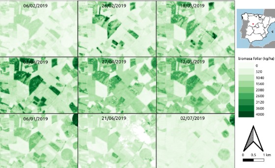

Weekly images of your farm
Monitoring every 5 days thanks to the European Space Agency's Sentinel images.

Anomaly detection
Early warning by constant satellite monitoring, and detailed damage and disease mapping with drone flights.

Decision support
Decisions support system for using fertilizers, water and pesticies.

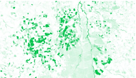
Leaf biomass
Estimates of crop biomass and monitoring of crop growth and development.

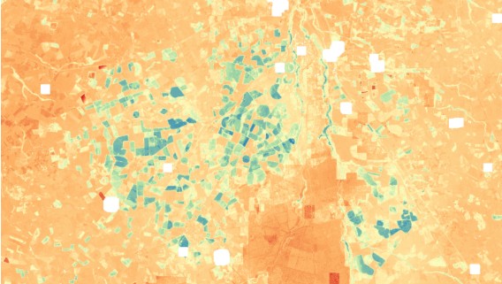
Chlorophyll concentration
Crop nutrient status and prescription maps for precision fertilization.

Water consumption
Amount of water used by the crop, and comparision with its optimal water consumption.
MAIN CHARACTERISTICS
Agrotig will help in decision making for a more eficiient use of resources in agriculture (i.e. fertilizers, herbicides, water, …). It will allow a localized usage of inputs, including its seamless integration in variable-rate distirbution systems, and hence better yields with both a significant resource savings and an environmental benefit.
Field analysis
Early warning system
Images every 5 days
OUR OBJECTIVE
In Agrotig we use the state-of-the-art know-how on physical and crop models to estimate crop biophysical status and its needs.
We produce high quality cartographic products, accounting for leaf biomass, chlorophyll and nitrogen concentration, as well as crop actual evapotranspiration.